This name was given to the city of Umm el-Jimal due to its important and main location as a stop on the camel caravan route. Umm el-Jimal, like other sites in the region, was built using black volcanic stones, due to the scarcity of wood. Nabatean inscriptions and tombs were found in and around the city. A total of fifteen churches were discovered in the area, the oldest of which was the Julianos Church, which dates back to the year 345 AD.
The first century BC was the golden age of the small kingdom established by the Arab Nabatean tribes in present-day southern Jordan. Its borders extended to the present-day southern Syria. The Nabatean convoys roamed the desert carrying commercial goods from their countries, the Arabian Peninsula, and perhaps India as well. They reached Egypt, Syria and Persia, so stations had to be set up on the roads, especially in the vast desert.
The Nabateans established “Umm el-Jimal”, and perhaps its basic name is “Thantia”, which a number of ancient geographers mention that it is in this desert region and its location is unknown, to be a rest stop for commercial caravans between Petra, the capital of the Kingdom and the Levant. It was at first a small center that became more important with the flourishing of trade along the Petra-Sham line.
Umm el-Jimal is located in the heart of the Jordanian desert, to the east of the city of Mafraq, 15 kilometers away from it and close to the old Baghdad Road. It was built with black volcanic stone left by volcanoes in that region. Nabatean writings were found in it, but it does not mention its name in those days. Many Nabatean tombs were also found outside the wall, most of which were burials of noble families.
Water is essential in every place and time, especially in the desert. The inhabitants of Umm el-Jimal dug a well for every house, and the authority built large pools, and built dams to store winter water. Some wells are still valid to this day. Also, many large squares were prepared inside the city for the establishment of the caravans that were covering it, which is the reason why it was called Umm el-Jimal.
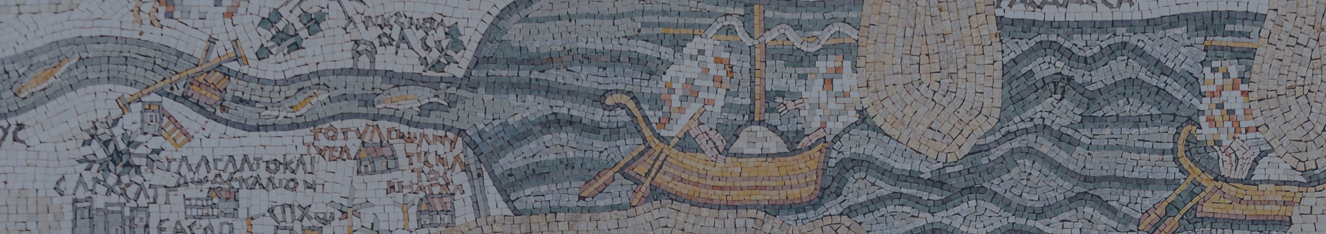
In the year 557 AD, a historical event took place in the city of Umm el-Jimal, namely the inauguration of the city’s cathedral. Participating delegations came from various neighboring dioceses in Jordan, Syria and Palestine. At that time, Umm el-Jimal was at the height of her glory and glory. The Madaba mosaic map, which dates back to about the year 565, that is, eight years after the inauguration of the cathedral, must have mentioned and painted the city of Umm el-Jimal and its cathedral and other cities and centers that enjoy some importance in the Jordanian desert.
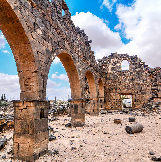
Fifteen churches were found in the city of Umm el-Jimal, and if they indicate anything, they indicate the flourishing of Christianity and its ancient origins, and the piety of its people and their love for Christ. It is not surprising that the city is the site of the migration of tens of thousands of people and caravans, so the ecclesiastical authority must have taken a spiritual interest in the Christians coming to the city with the caravans from all sides. The oldest church is Julianos Church, which dates back to the year 345.
In the Byzantine era, the military barracks turned into a monastery, and today it is called “the monastery,” and this is indicated by the inscription found on the tower in the southeastern corner. Its four sides are inscribed with the name of one of the Archangels: Gabriel, Michael and Raphael. And on the fourth side wrote the name of Uriel, a mythical angel. The barracks is a rectangular building with a church of three galleries, and around the church is an open courtyard surrounded by one or two rows of rooms.
Among its most prominent churches is the Western Church located near the Commodus Gate. Its main entrance is about twenty-four meters long, and its nave is about twenty-two meters in width and sixteen meters. Next to the temple are two arches engraved with crosses. The church is surrounded by two porticos on the north and south, and between the naves. The porticos are two rows of arches.
As for the rest of the churches, some of them take the form of a large hall, and some contain a nave in the middle, separated from the side porticos by arches on bases.
Natural and commercial factors were the cause of the destruction of Umm el-Jimal and the abandonment of the population. The terrible earthquake that occurred in the year 746 and the radical change in the trade routes were the main reasons for the economic and architectural demise of Umm el-Jimal, and for her burial in the tomb of oblivion. The caravans passed away from it, and no one dreamed of what lay among its ruins, except for some Bedouins and inspectors for gold and treasures.
Umm el-Jimal was compelled to be forgotten and neglected, and other cities to be established and prospered, but it remained faithful, speaking to those who read the language of antiquities about its fading glory and past glory. It is beautiful and beautiful according to what its news and effects in its Christianity say.